
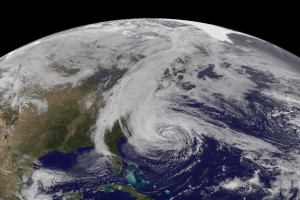
Hurricane Sandy as seen from GOES-13 satellite on October, 2012 (Credits: NOAA/NASA).
The Geostationary Operational Environment Satellite 13 (GOES 13) suffered a failure in its attitude control system on May 22. The weather satellite, owned by the National Oceanic and Atmospheric Administration (NOAA), is in charge of covering the eastern United States and the Atlantic Ocean, providing images for weather forecast, storm tracking and meteorological research.
“It appears to have been a problem with the star tracker, which caused the satellite to lose its position hold capability,” said Kathryn Sullivan, acting NOAA administrator and former NASA astronaut.
NOAA officials reported that engineers are looking into the root cause of the glitch before trying to recover GOES 13. The agency also stated that they are in contact with the spacecraft and there are no other reports of faults to other systems. GOES 13 is placed in a geostationary orbit at 35,786 km over the equator and at 75° west longitude.
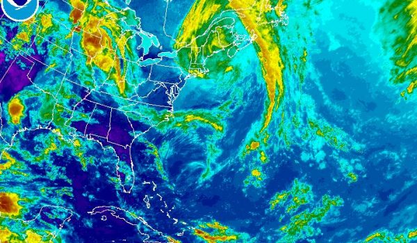
Infrared image of Northwest Atlantic Sector taken with GOES 14. GOES 14 does not have complete view of the area in the Atlantic Ocean where hurricanes are usually generated (Credits: NOAA).
The news raised concerns because the glitch came just a week before the official start of the Atlantic hurricane season, on June 1. Due to its particular position, GOES 13 was covering the area in the Atlantic Ocean where tropical cyclones usually originate, providing fundamental information to weather forecast services. However, NOAA reacted immediately activating GOES 14, the backup satellite, and starting collecting imagery with it on early May 23. According to Sullivan, the satellite had to be tuned to provide close-up images every 5 minutes. This rapid-scan operations mode is fundamental to track and observe fast-developing storms and it was used also to monitor the tornado event in Oklahoma.
If the issue on GOES 13 takes too long to be resolved, GOES 14, now located at 105° west longitude, will be moved further east, to have complete coverage of the Atlantic hurricane development region. Until then, American meteorologists could also use images from other NOAA’s polar satellites and from Meteosat-10, a geostationary satellite operated by EUMETSAT, the European Organisation for the Exploitation of Meteorological Satellites.
GOES 13 remained also out of service between September and October 2012 due to a mishap in the satellite’s payload. Although the satellite was launched in 2006, and was designed for a 10-year lifetime, GOES 13 only became fully operational in 2010, when it replaced GOES 12. Previously it was activated for short periods to provide coverage when GOES 12 was experiencing technical difficulties.
NOAA is expecting a 70 percent likelihood of 13 to 20 named storms for the next six-month hurricane season. Among them, 7 to 11 could become hurricanes with three to six major hurricanes having winds at 180km/h or higher.


![A trajectory analysis that used a computational fluid dynamics approach to determine the likely position and velocity histories of the foam (Credits: NASA Ref [1] p61).](https://www.spacesafetymagazine.com/wp-content/uploads/2014/05/fluid-dynamics-trajectory-analysis-50x50.jpg)


Leave a Reply